Elevation Mapping
Using Google Earth
What's in the Way?
When you want to talk to someone on your radio, do you know what might be in the way? This tutorial will tell you how to generate an elevation map to show what might be between you and your QSO. So, let's get started:
If you don't have Google Earth on your computer, please install it. You can get the download here:
Google Earth
Open Google Earth and zoom into the area you want to work with. You can also type an address in the Search box in th top left of the screen.
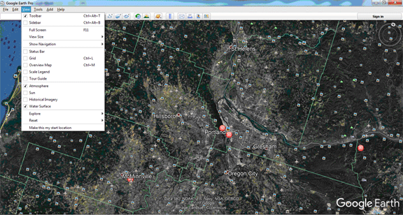
The earth will turn and zoom in to the area you've chosen. Use the zoom slider on the right to zoom in or out until you can see both your QTH and the QTH you want to reach with your radio. You can also use the wheel on your mouse to zoom in and out.
You can go to the View menu at the top and click or unclick these boxes - it's optional.

On the top menu bar, click Add Path button. This popup will appear:
Give the path a Name (Do Not click on OK yet)
Move the Path box off to the side by doing a click&hold on the "Google Earth - New Path" bar.
Use your mouse to click on your start location, last location and points inbetween if you wish.
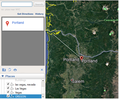
I have made a path from Portland to Astoria near the coast. Now you need to click on the OK in the Path Name box.
Notice this new path in your Places on the left sidebar (OREGON).

Right click on the path name (OREGON) and choose Show Elevation Profile.
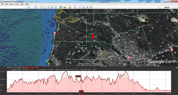
An elevation profile will appear in the the lower half of the 3D Viewer. If your elevation measurement reads "0," make sure the terrain layer is turned on.

See the red vertical line near the center with the numbers in the two red boxes? Click/Hold it and you can move it along the elevation map. Also a red arrow will appear on the Earth photo and move along your path as you move it across the elevation profile.
To see the elevation and distance at different points along the path, mouse over the path.
To change measurement units (feet, meters, etc.) on a Windows computer, select Tools then Options. Then, under "Units of measurement," choose feet or meters.
To change measurement units on a Mac, select Google Earth then Preferences. Then, under "Units of measurement," choose feet or meters.
Tutorial courtesy of CJ - K7CJS. If you have any questions you can contact K7CJS at K7CJS@arrl.net.
You can watch this YouTube video to get a better visual idea how it works.